Urban study of Hodonín – Pánov
The goal of the project was to design quality housing including services and job opportunities. Due to the expected number of inhabitants, it is not possible to build a completely separate town, but the new headquarters will contain civic amenities, shops and services, including employment opportunities. We tried to design a place where you can live well and which offers affordable housing. A place that is close to beautiful nature, that is a destination for the recreation of city dwellers and that offers spaces for science and research.
| Project: | Urban study of Hodonín - Pánov |
| Authors: | Pavel Hnilička, Jan Pačka, Daniel Sedlák, Milena Raičević, Veronika Žďárská |
| Collaboration: | Transport solution: Josef Filip, Technical infrastructure: Miroslav Procházka, ÚSES: Jan Dřevíkovský |
| Client: | The town of Hodonín |
| Solved area: | 31,2 ha |
| Year: | 2024 |
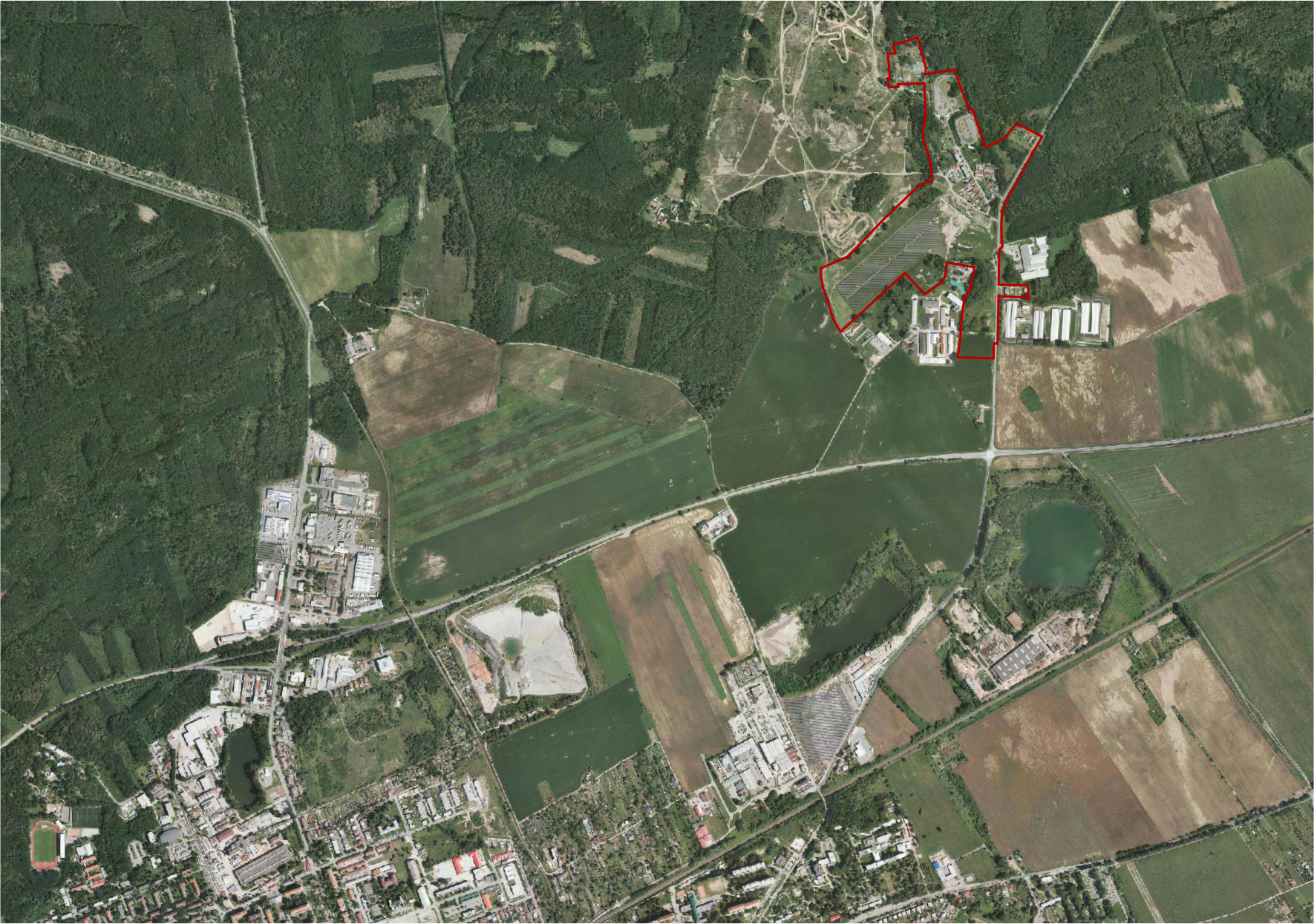
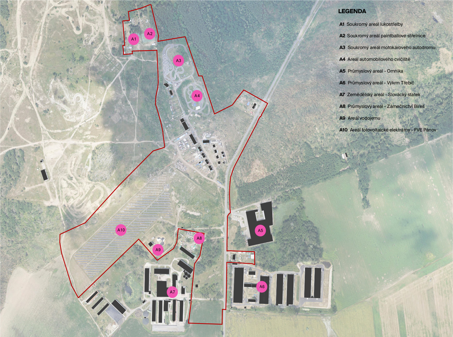
The settlement of Pánov is located north of the town of Hodonín. It is an independent enclave today located between forest stands, areas of artificially created steppes and areas of non-urbanized agricultural and production areas. This is an area with a very diverse and fragmented urban structure.
The existing settlement structure in the treated area is characteristically fragmented and is an interesting example of a modern, growing settlement that is being created rapidly, according to immediate need, on currently vacant land. However haphazard the development of the location was, the germ of a settlement was created here, which is viable, functionally structured and has the potential for further development.
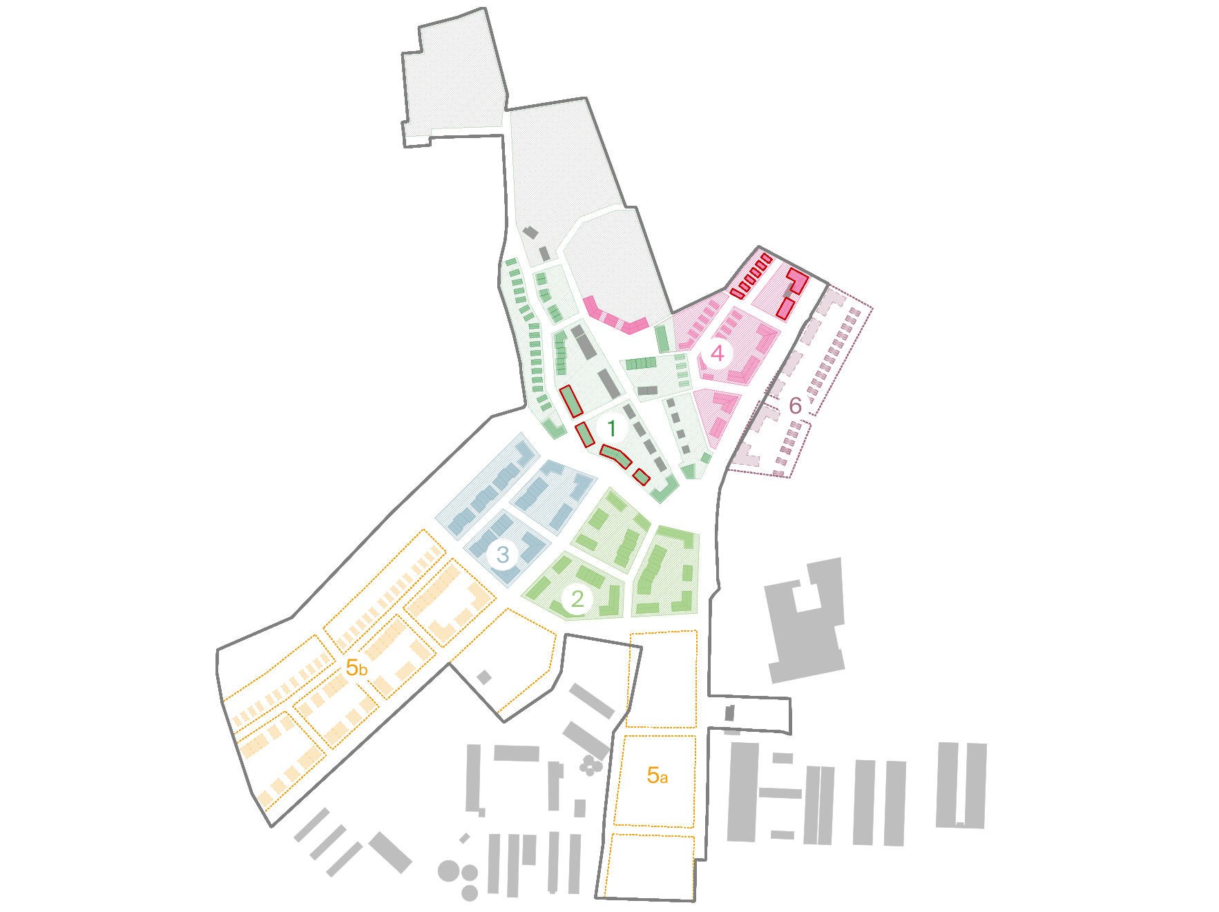
With our urban design, we would like to let the preferred number of new people and new energy into the place. New energy will certainly bring new impetus. That impulse will certainly encourage new changes that will require a new program and content.
Above all, the place needs massive investment, which cannot be managed without a critical mass. The general needs of the site are investments in public infrastructure and the creation of a critical mass, which follows on from the profitability of investments in technical infrastructure and the sustainable development of the site.
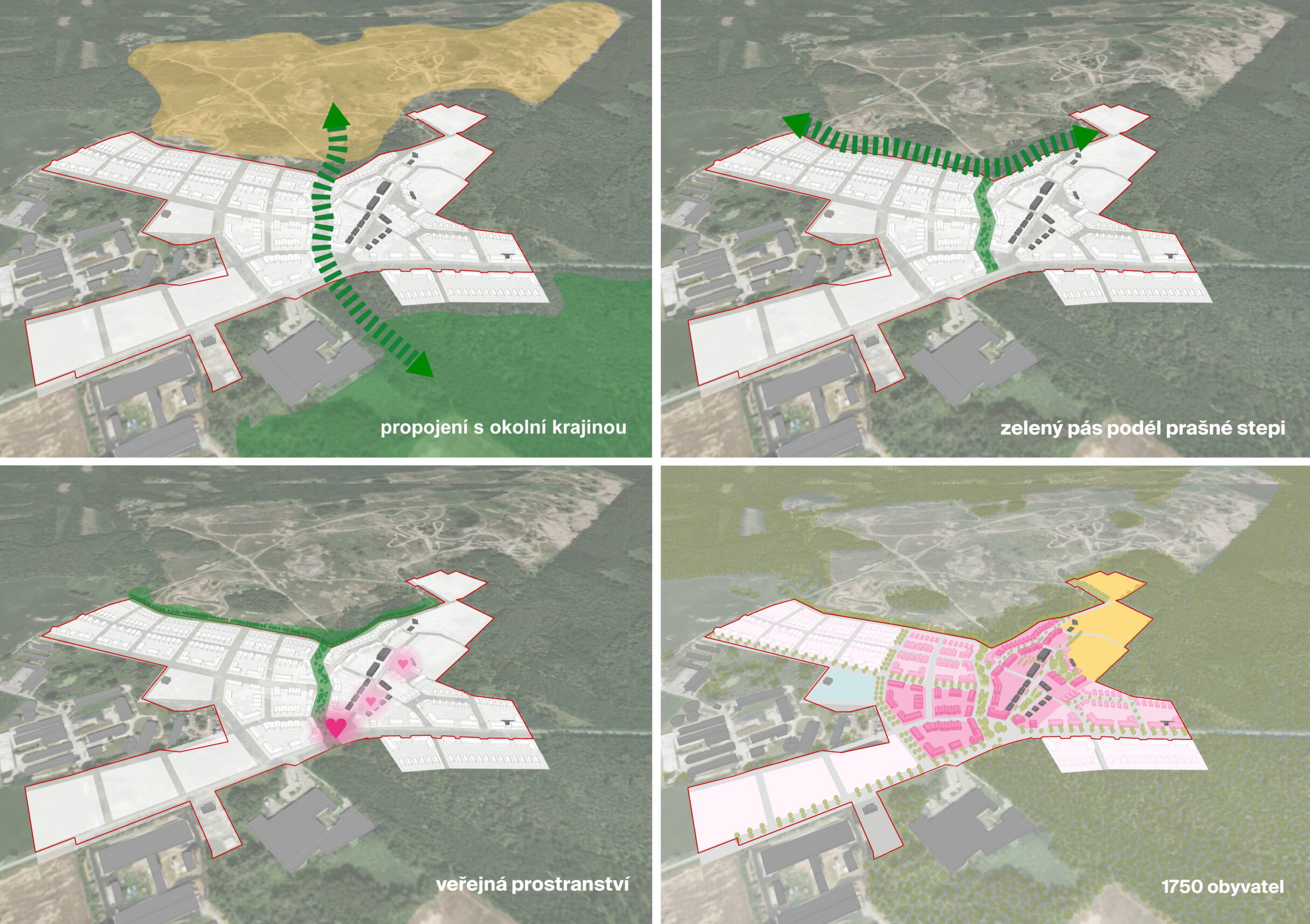
Solved area is taken from the client and is defined in the assignment of the spatial study from 2022. The area of the area to be addressed is 31.2 ha. As part of the analytical part, the territory was viewed in broader contexts and connections. It is necessary to include both the immediate surroundings and relatively distant elements and phenomena of landscape, infrastructural and urban nature in the analytical and later also in the design phase. Specifically, it is necessary to perceive and work with landscape elements – forests, meadows and steppes in the immediate vicinity, and at the same time with production and agricultural areas in the south of the territory.
The success of the solution depends mostly on the quality of the public spaces and their atmosphere, which is determined not only by the spaces themselves, but especially by the subsequent construction. Orientation in the territory, the memorability and character of localities significantly influence the feelings of current and future residents, therefore they must be worked with very sensitively in urban planning work.
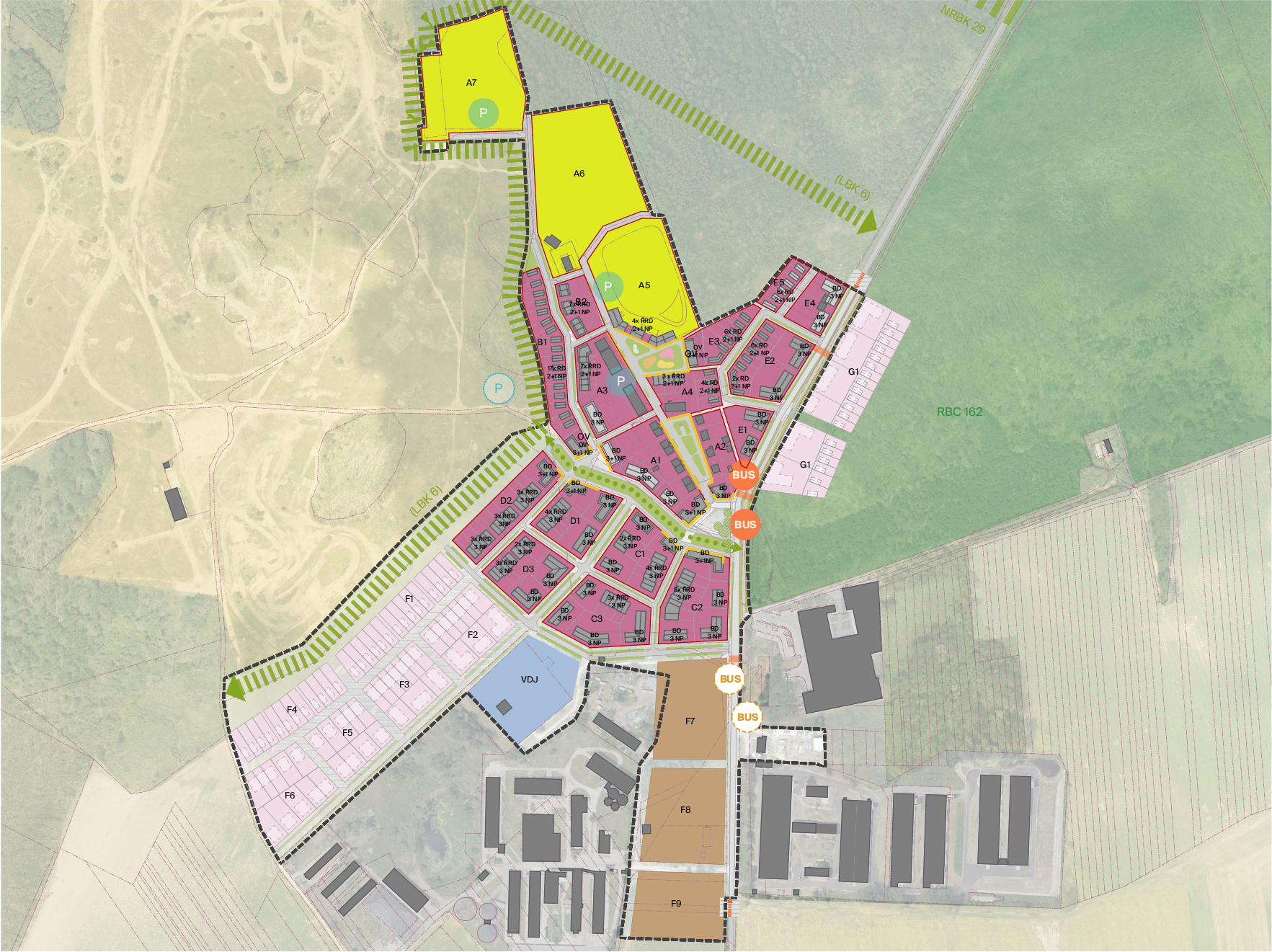
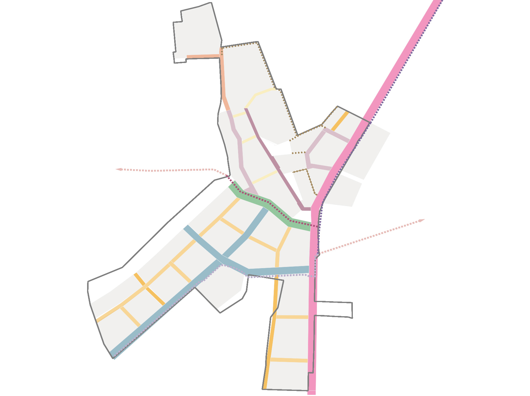
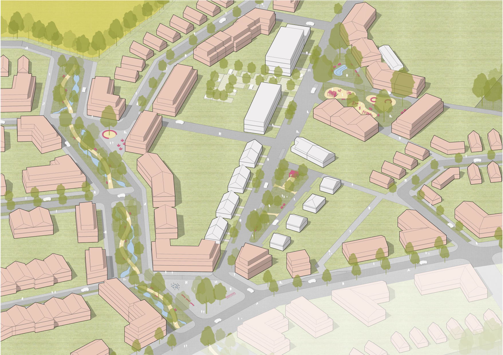
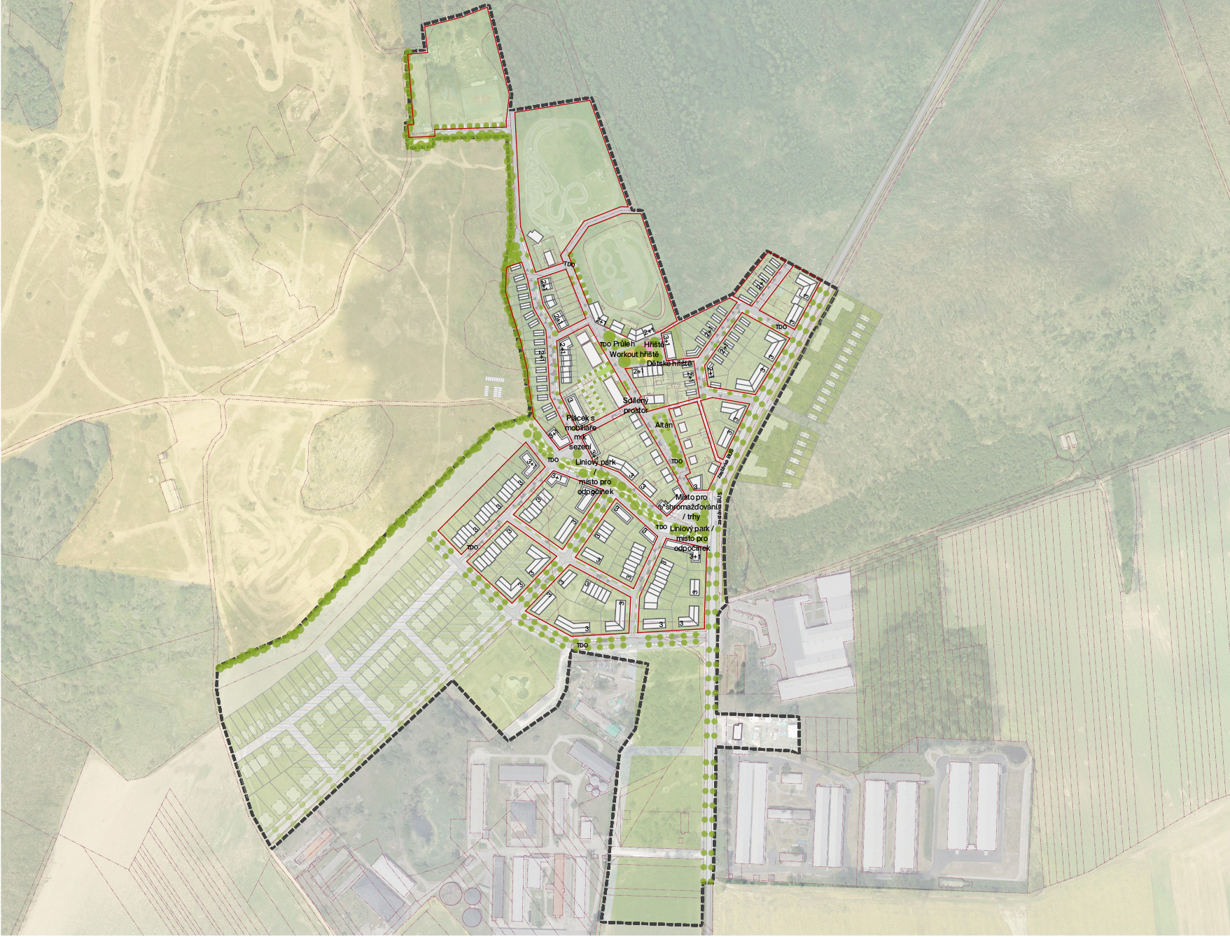
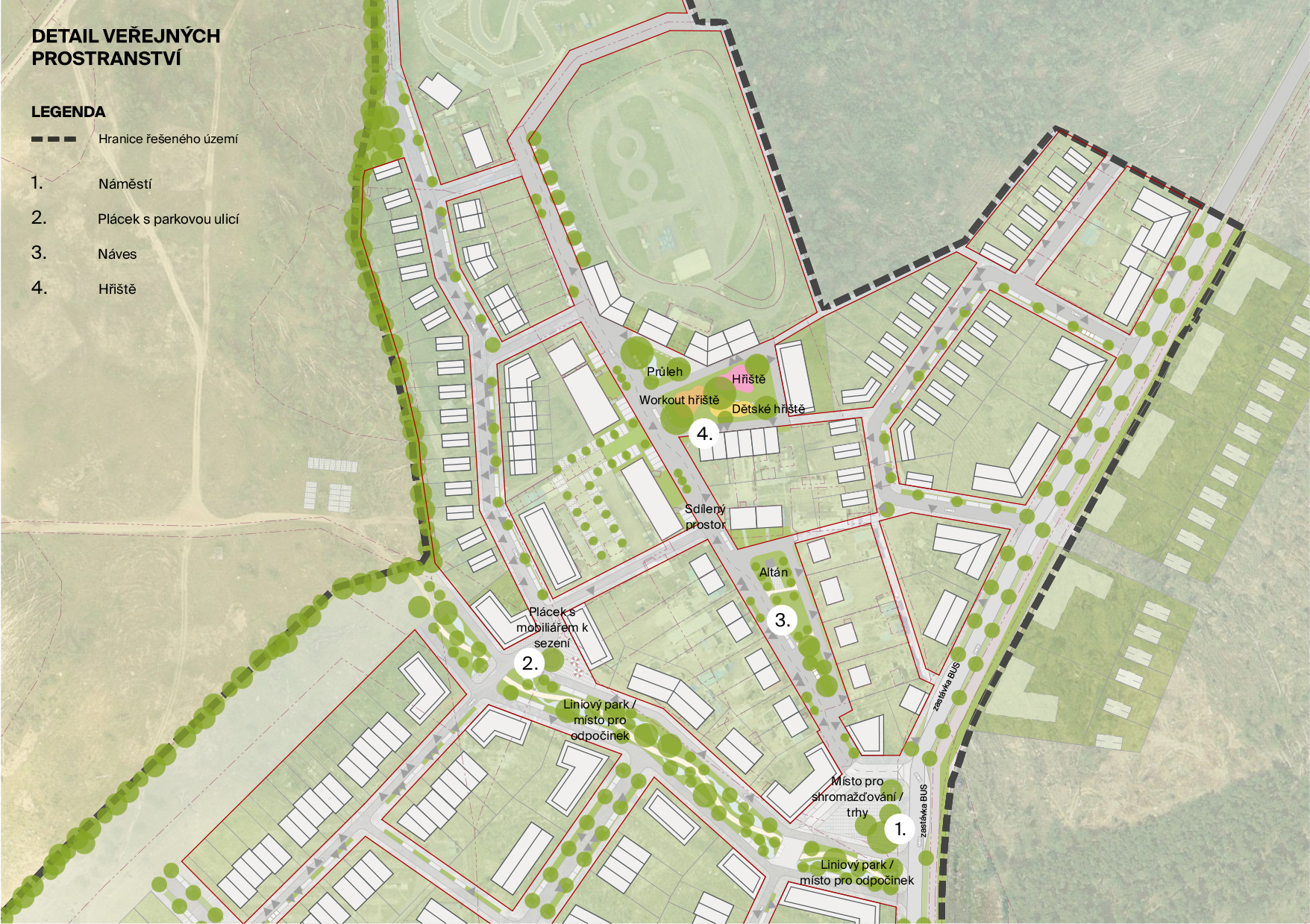
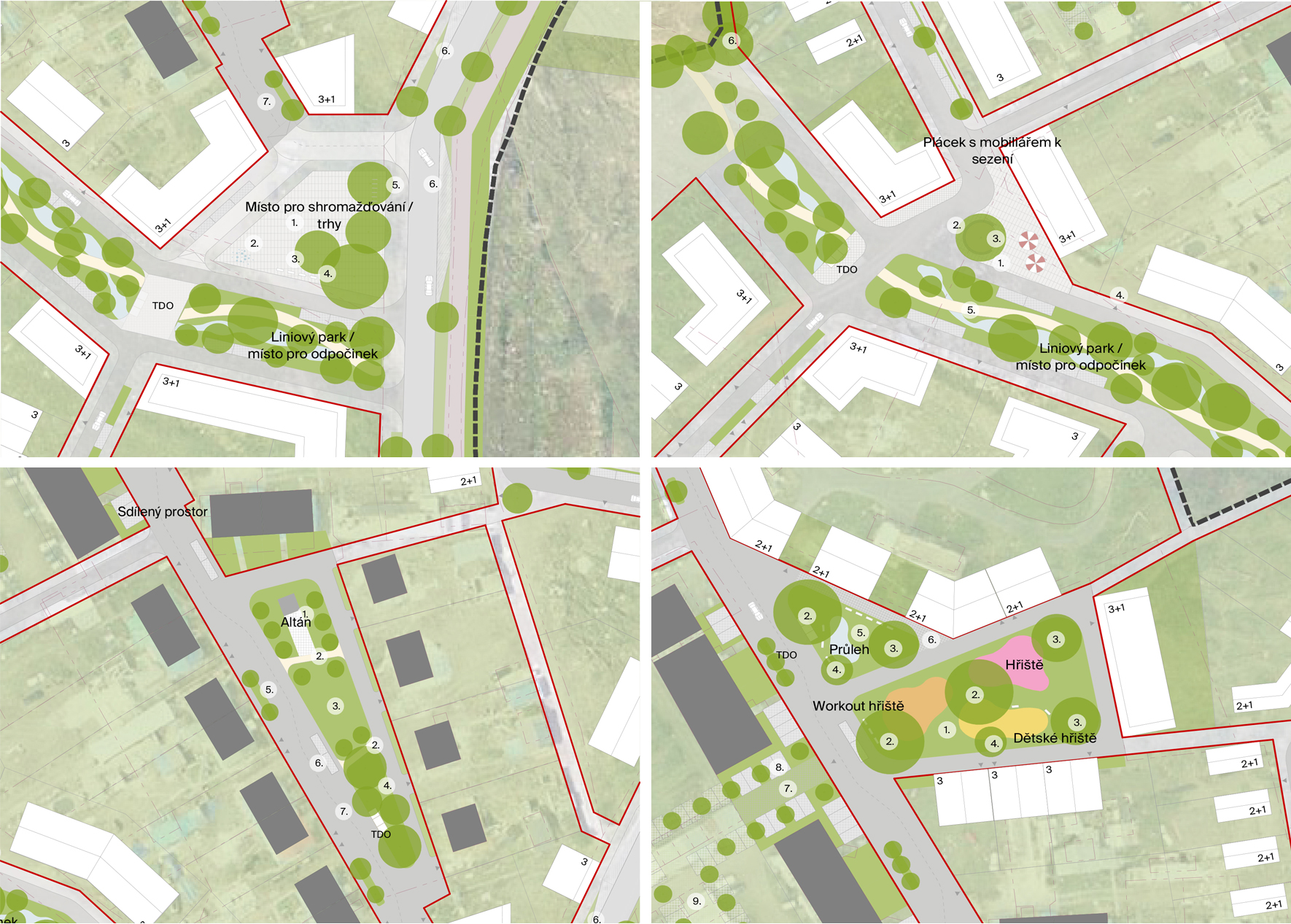
We are proposing a new center for the future development, which will connect to the main roads. It will act as a gateway to the center of the estate located at the transition between the existing and the proposed development. We also propose to move the existing bus stop closer to the new square and thus improve its accessibility. The layout of the streets, parks and squares will be essential for orientation in the place so that people get to know the place well and feel at home in it.
We want to preserve and respect the existing public spaces, the village area in the central part of the residential area and the area with a children's playground in front of the apartment buildings. We see great potential in those places. We just want to emphasize this potential, to better define the spaces and functions inside these places by working with different materialization, arrangement of trees or street furniture.
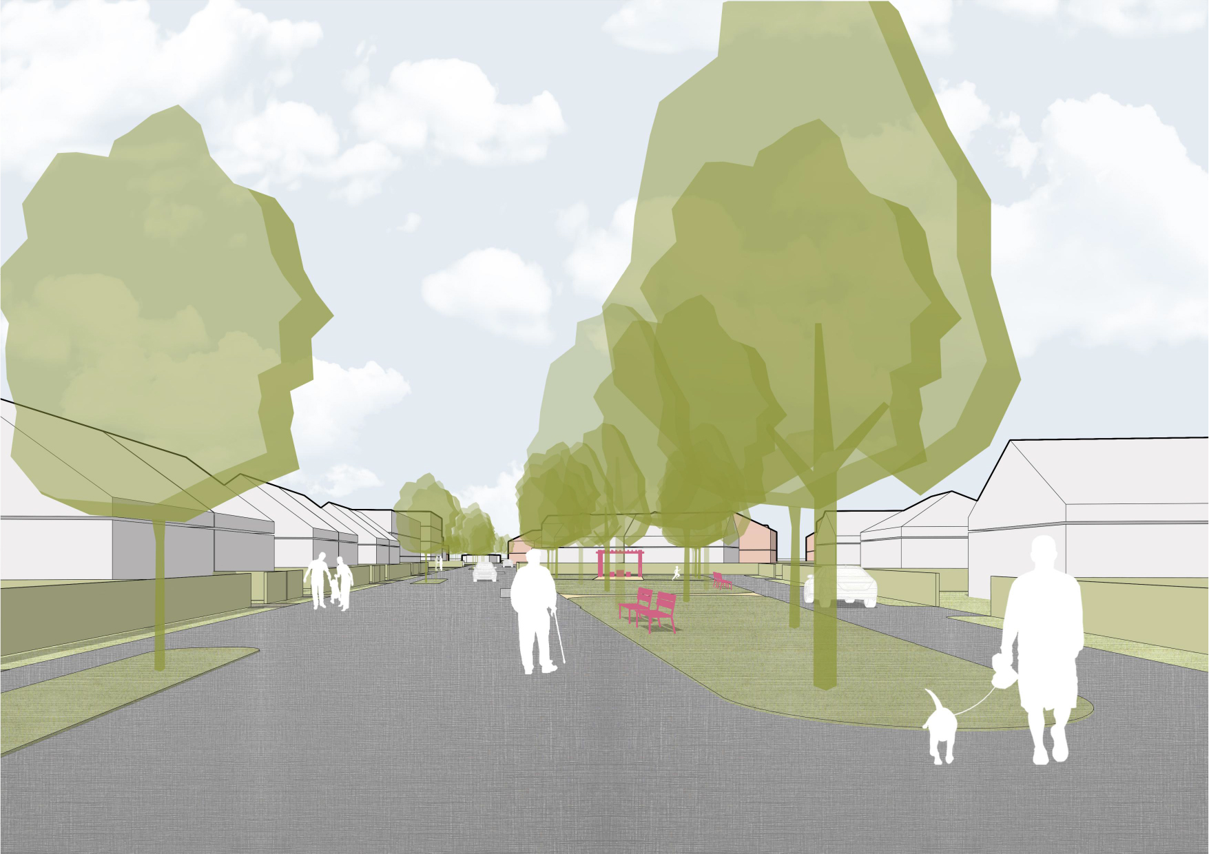
The area of the village is clearly defined by the street line of adjacent plots with family houses, so it has a clear geometric identity. The space is functionally divided between traffic areas and public green areas. We want to preserve this space and carry out its reconstruction.
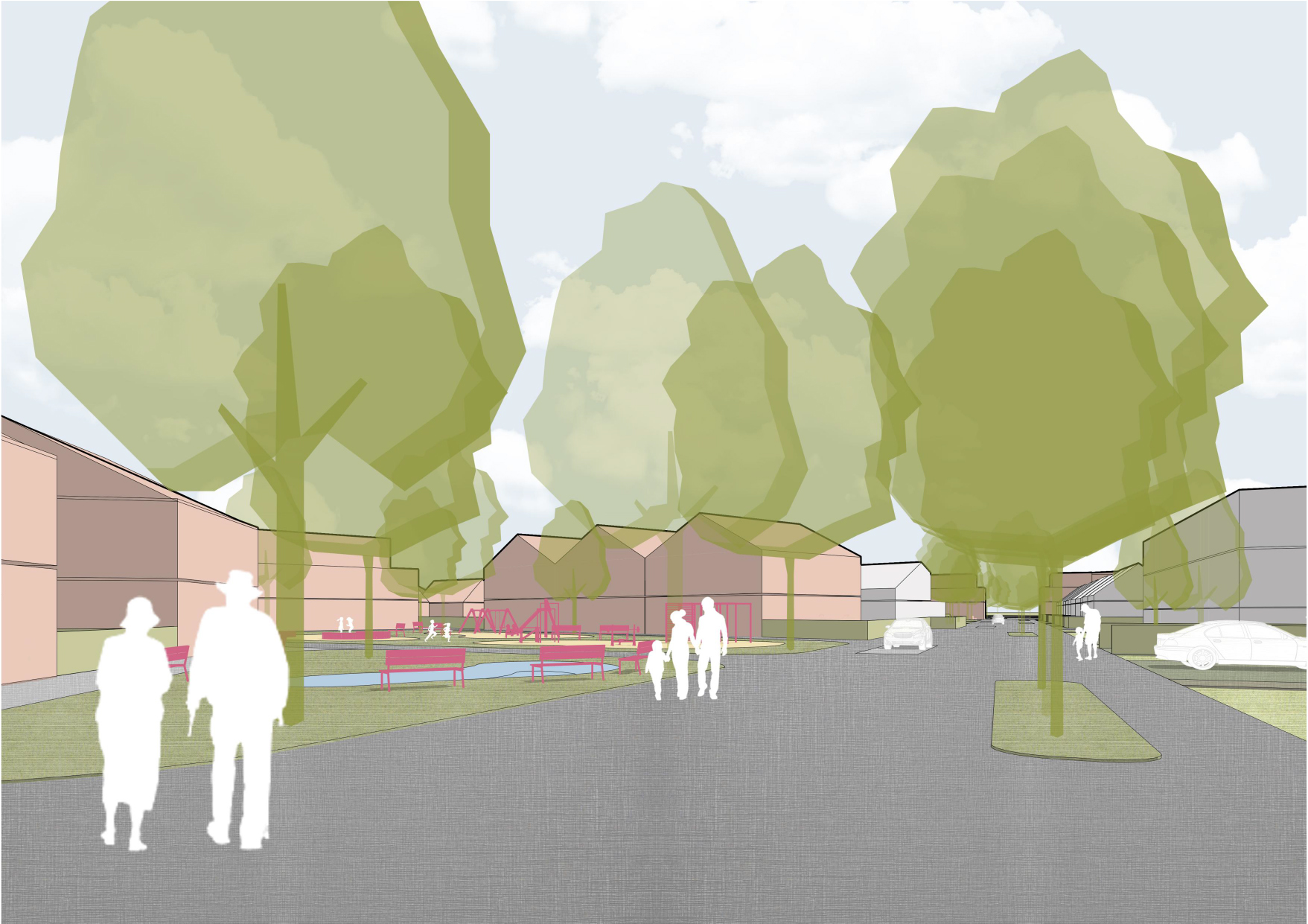
The public space with the children's playground no longer has such a fixed geometrical demarcation and is actually a residual piece of land that historically arose at the boundary of property boundaries and public roads. We want to preserve this space and convert it into a public green space with a suitable park arrangement.
In the area of existing family houses, we work with shared space, where we add slowing down elements, such as green islands with trees and parking areas for users of adjacent sports and recreational areas. For the existing public spaces, we propose a new plot with seating furniture and a new square.
