Zoning plan of České Budějovice
The new master plan for České Budějovice will set out ambitious visions for the city’s development while maintaining the necessary flexibility for future growth. Its goal is to create a tool that is clear and understandable for spatial decision-making, yet realistic in its proposals and objectives.
The proposed concept emphasizes the promotion of mixed-use urban districts, the development of high-quality public spaces, and ensuring good access to essential services and facilities within the natural vicinity of residents’ daily lives.
In the proposal, the committee clearly recognized the potential of the future plan, which will offer the necessary flexibility, enable a response to the requirements of sustainable development, support population growth, and simultaneously contribute to improving the quality of the environment.
| Project name: | Zoning plan of České Budějovice |
| Competition result: | 1st place |
| Authors teams: | Pavel Hnilička Architects+Planners (CZ), Studio MAP (CZ), Omgeving (BE) |
| Authors - PHAP: | Pavel Hnilička, Jan Pačka, Jana Končáková, Mikuláš Valdman, Lucie Leňo Cutáková |
| Authors - Studio MAP: | Jan Šíma, Lenka Šímová |
| Authors - OMGEVING: | Peter Swyngedauw, Daphne Roels, Simona Reiciunaite |
| Co-operation: | Mott MacDonald, Studio Relinkt, Štepán Špoula |
| Client: | The city of České Budějovice |
| Year: | 2025 |
KEY ISSUES FOR THE DEVELOPMENT OF THE ZONING PLAN
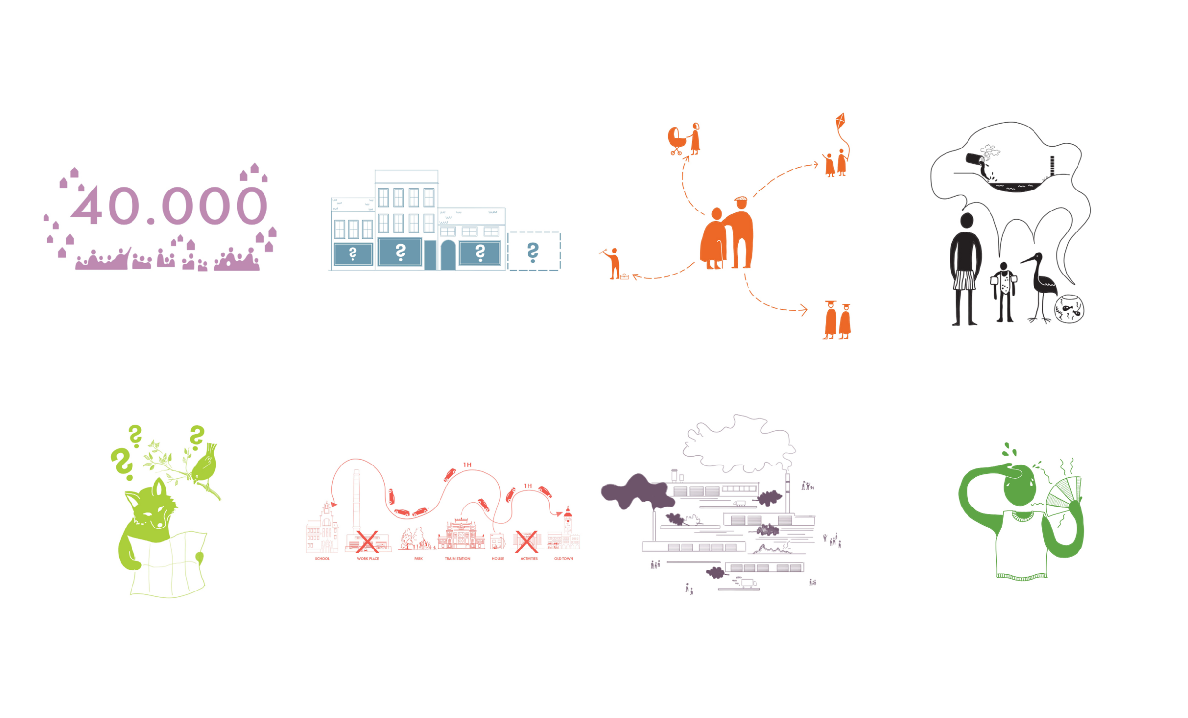
How can we increase the city’s capacity by approximately 40,000 new residents while preserving the quality of the urban environment? How can we provide sufficient high-quality and affordable housing and/or other types of housing to address demographic changes?
How can we manage the limited available space to provide sufficient functions and activities without damaging the open landscape on the city’s outskirts? How can we support community life and vibrant streets?
How can we create a city that is welcoming, friendly, and inspiring for all residents? How can we ensure that the city is accessible, attractive, and functional for all generations and diverse groups of residents?
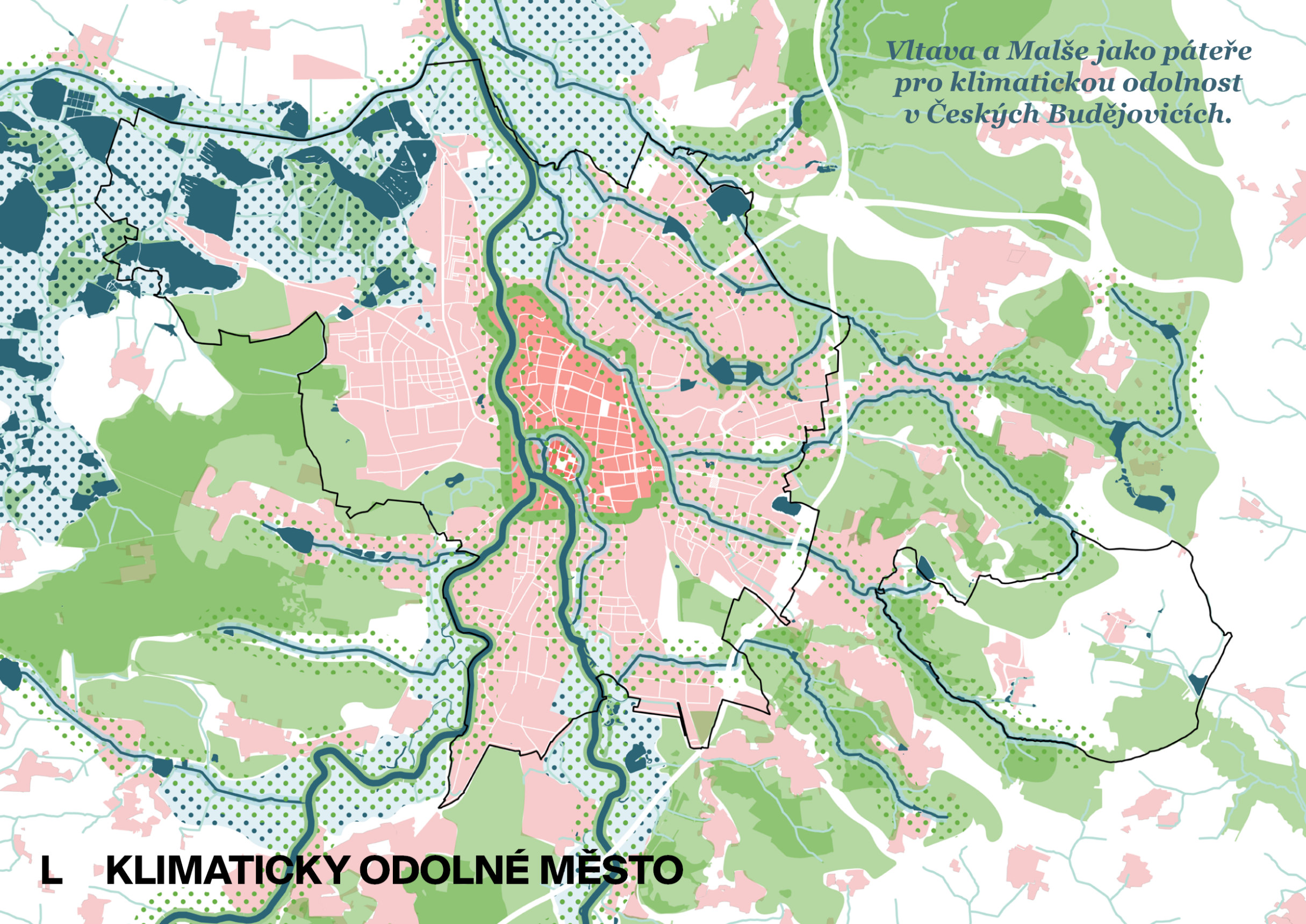
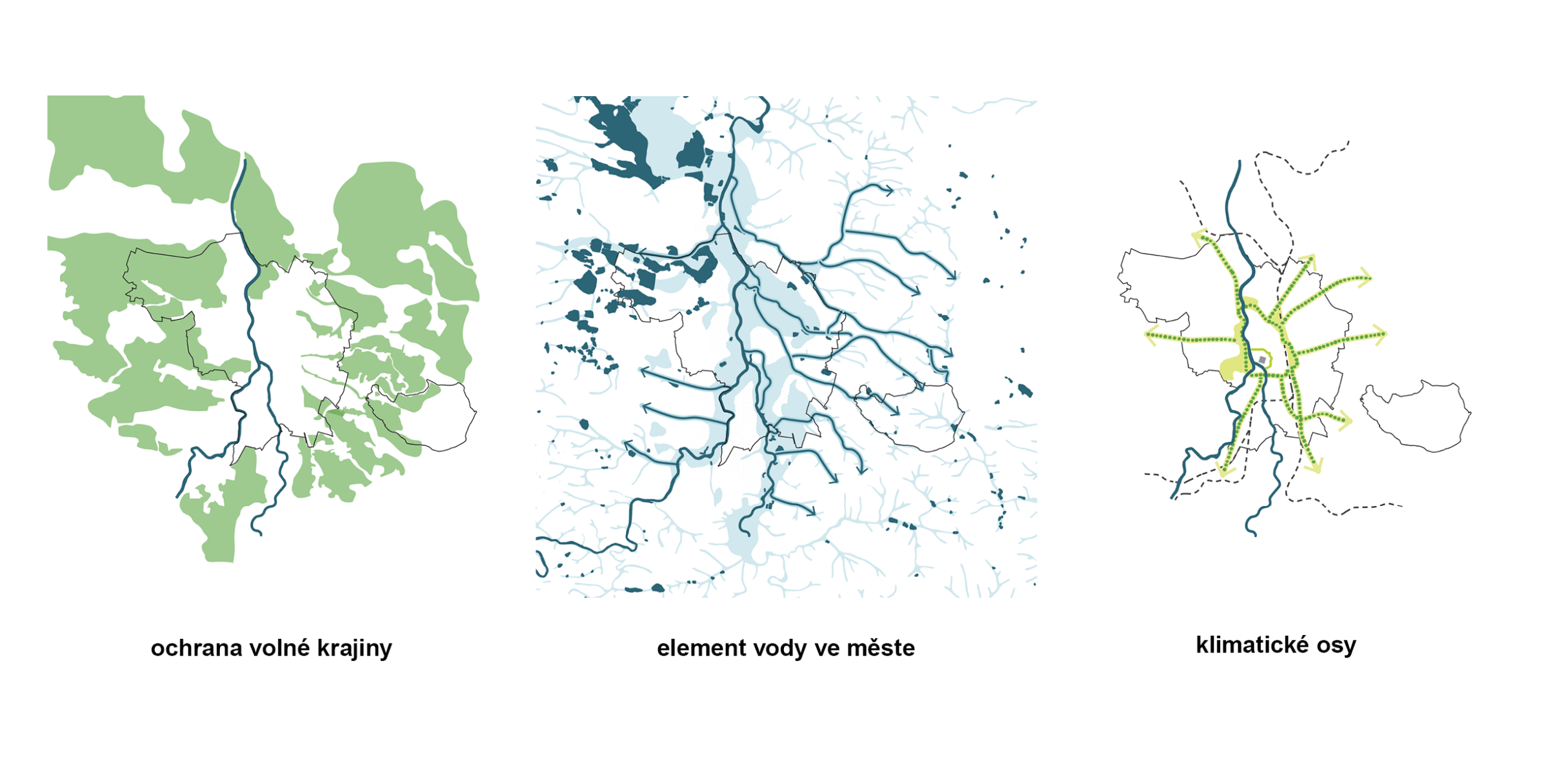
How can we effectively harness the potential of the Malše and Vltava rivers and water as a key element of the urban landscape?
How can we create and integrate safe habitats for animals and their ecosystems into the urban fabric? How can we preserve and enhance biodiversity?
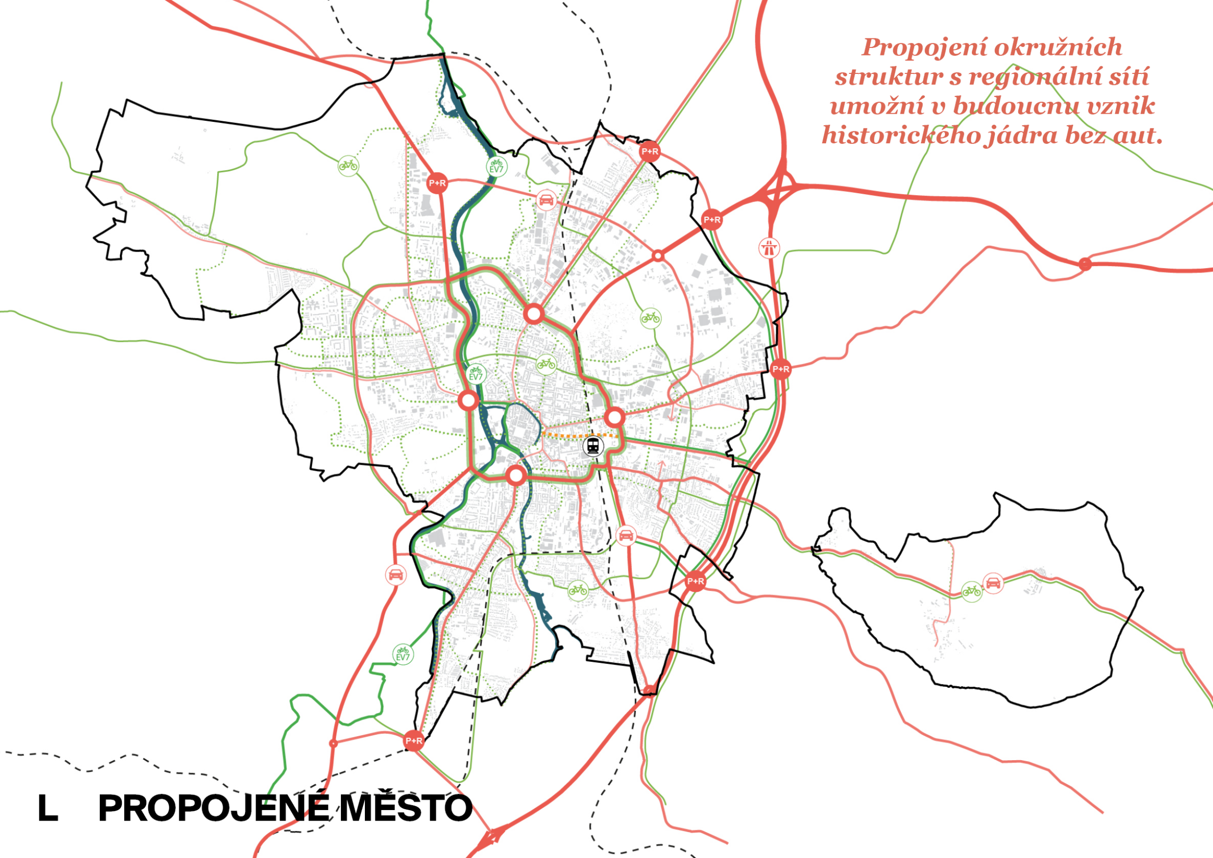
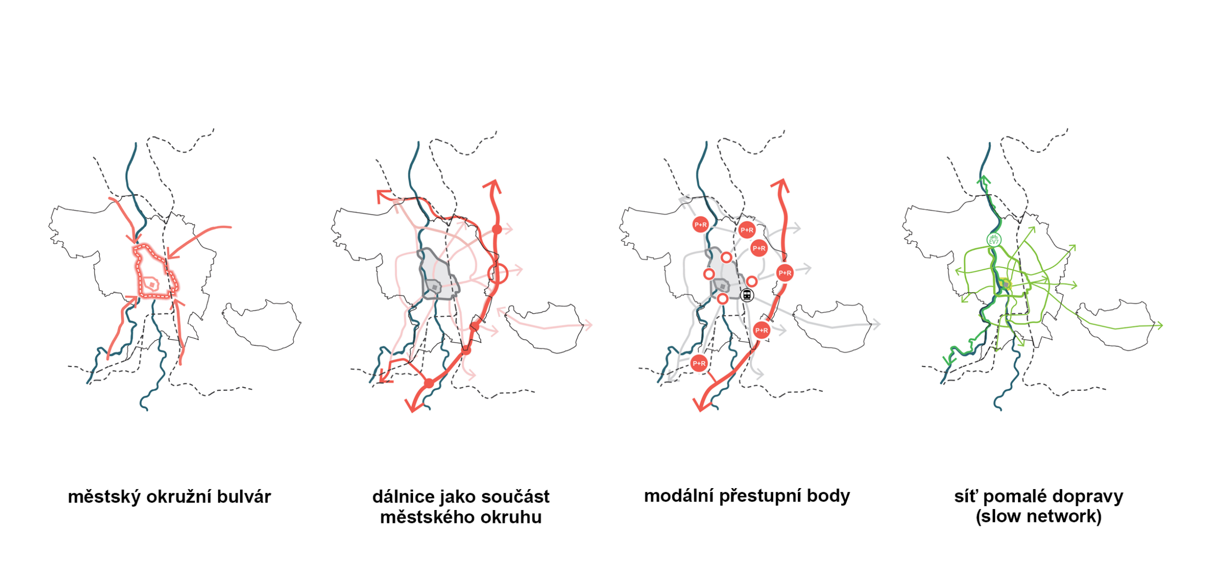
How can we make the city more accessible and safer for transportation? How can we reduce the need for car travel and promote walking and cycling?
How should we set rules for expanding industry? Where should we locate areas for high-tech industries?
What measures should we propose to enable the city to adapt to increasing heat waves, droughts, and floods? How can we ensure that the city is resilient to climate change and prepared to face its long-term impacts?
THE CITY'S VISION
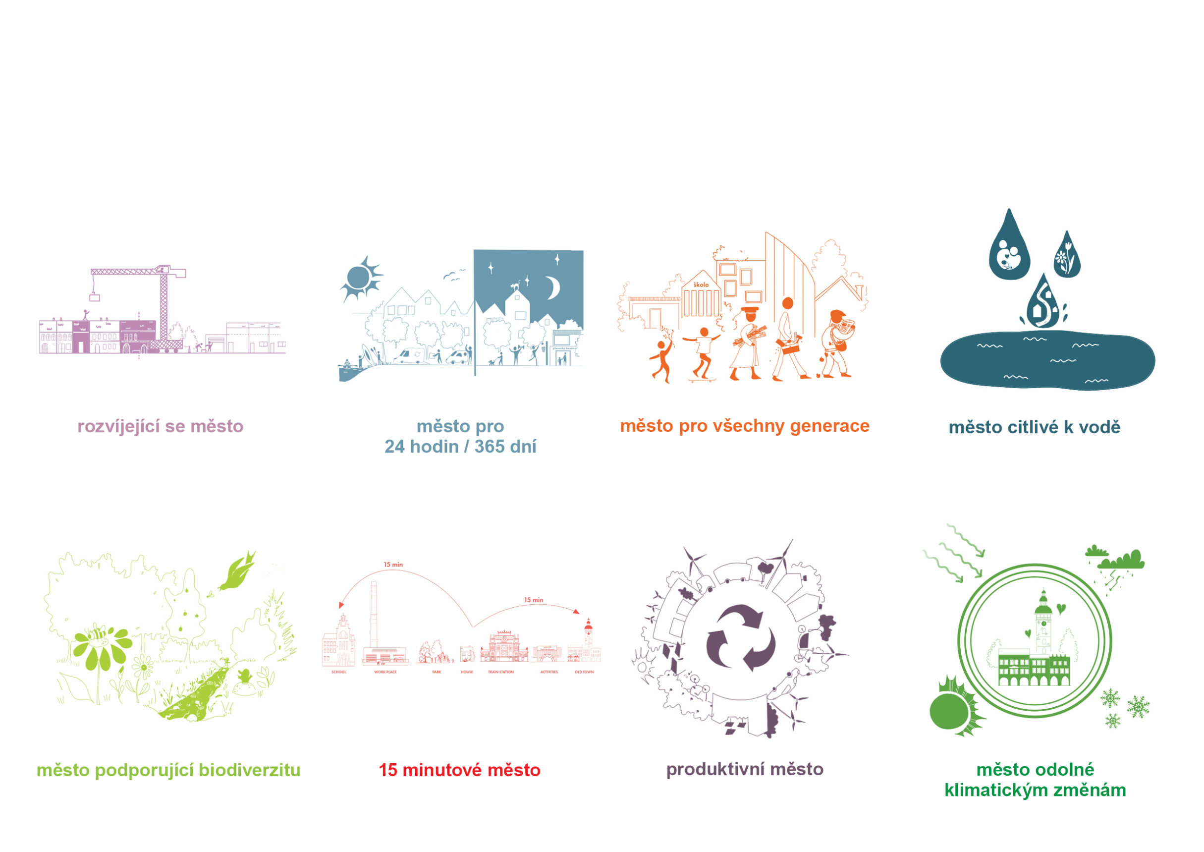
A Growing City
A city that is not only expanding in size by approximately 40,000 residents, but has also committed to providing quality housing for every resident through a suitable mix of housing types.
A City for 24 Hours a Day, 365 Days a Year
A city that never sleeps, which everyone can experience all year round. Both indoor and outdoor spaces come alive day and night, on weekends, and are adapted to all weather conditions.
A City for All Generations
A city where everyone wants to live: from children who can attend quality schools, to students who can receive a proper education, to active residents who find good jobs, to the elderly who receive the care they need.
A water-sensitive city
A city that does not forget about water in any part of itself. Water is a source of life for people, plants, and animals. It connects different neighborhoods and enhances the experience of these places.
A city that supports biodiversity
A city that is not just a place for people. Other animals and plants also find a home here, and thanks to a robust and interconnected network of blue-green infrastructure, they can migrate.
A City of Short Distances
A city where residents can access all their basic needs within a 15-minute walk or bike ride from their homes.
A productive city
A city that is a hub of technology, knowledge, and innovation, and business-friendly: every form of entrepreneurial activity will have its place in the city, more or less interwoven with other functions.
A city resilient to climate change
A city that mitigates the impacts of climate change and adapts to them. Therefore, it is necessary to make more room for water and green spaces and to emphasize more sustainable transportation and renewable energy sources.
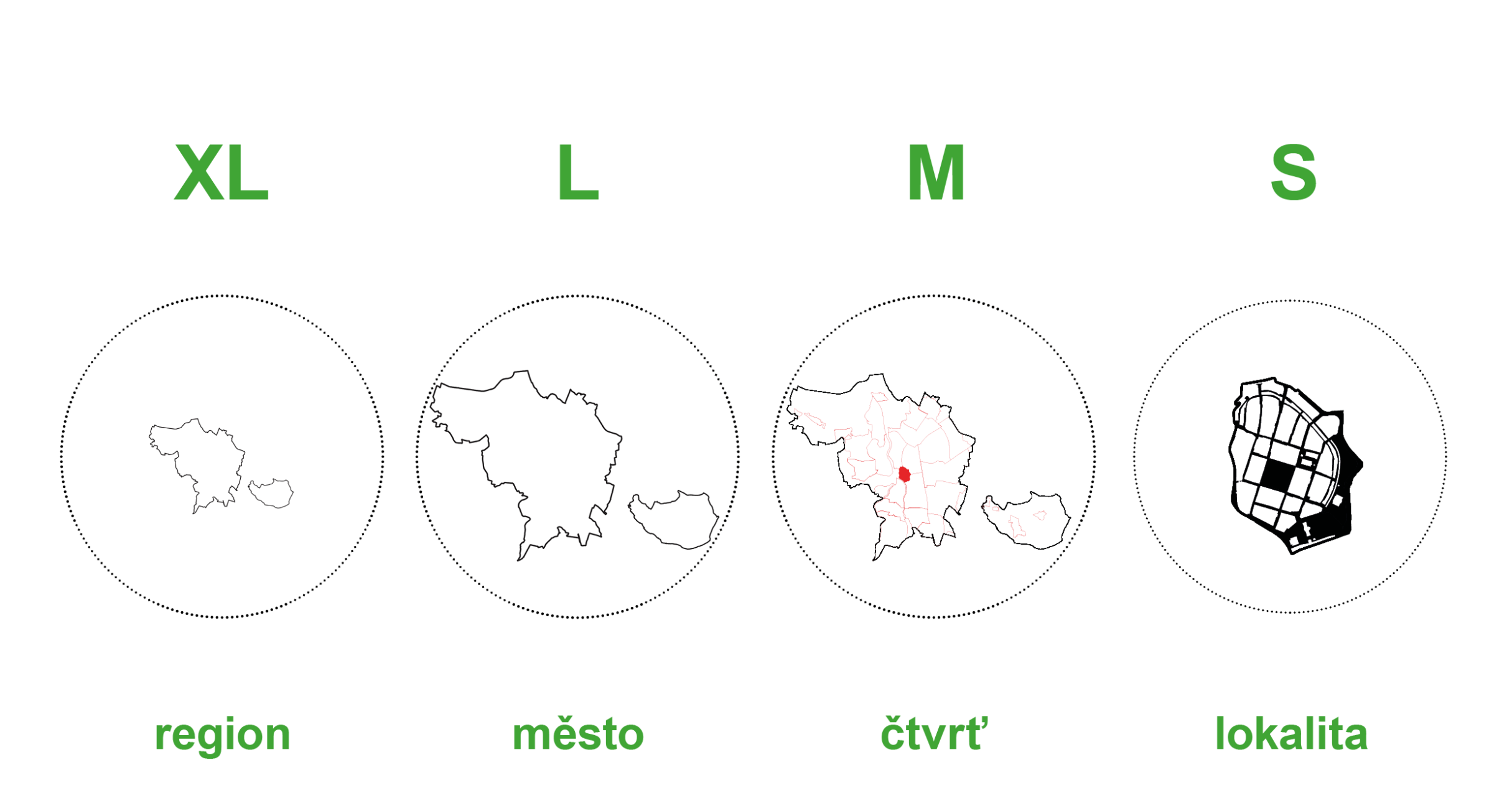
WORKING WITH DIFFERENT SCALES
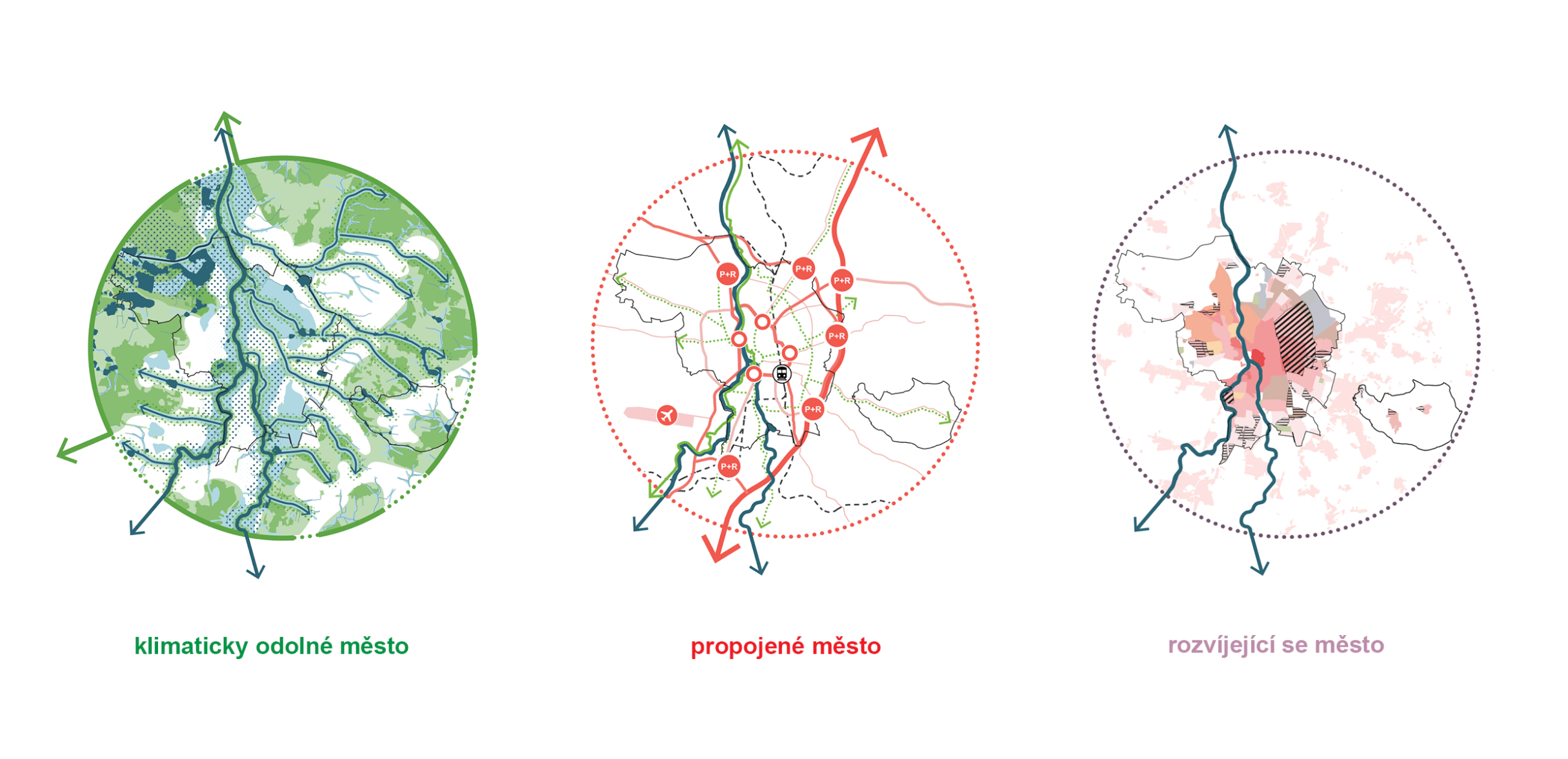
XL Metropolitan Level – The City’s Role in the Region
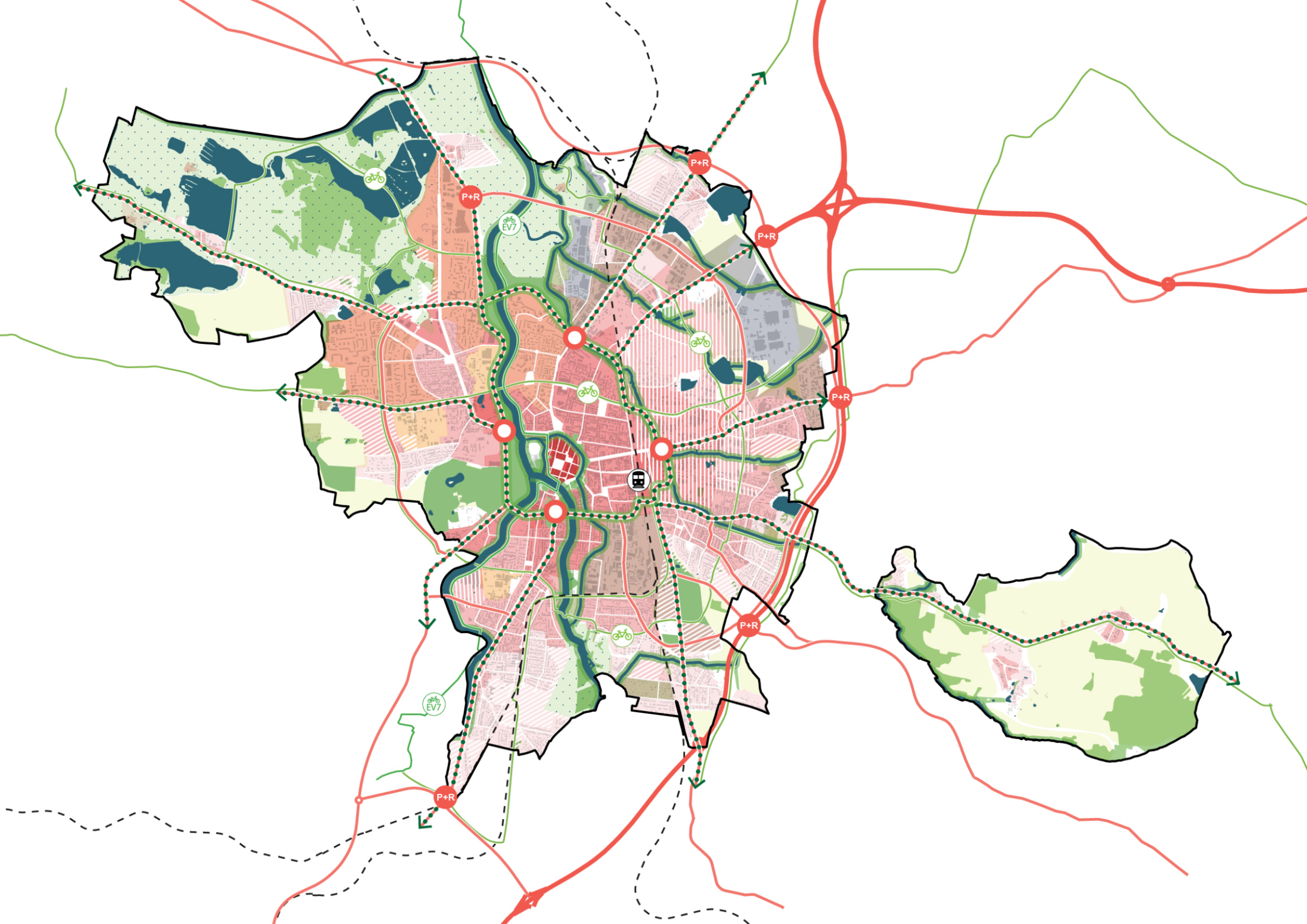
We are examining České Budějovice from the region’s perspective at the largest scale (eXtra Large). The draft zoning plan will take into account both the regional significance of České Budějovice and the connections between neighboring municipalities and the city of České Budějovice. České Budějovice is not an island but is interconnected with its surroundings.
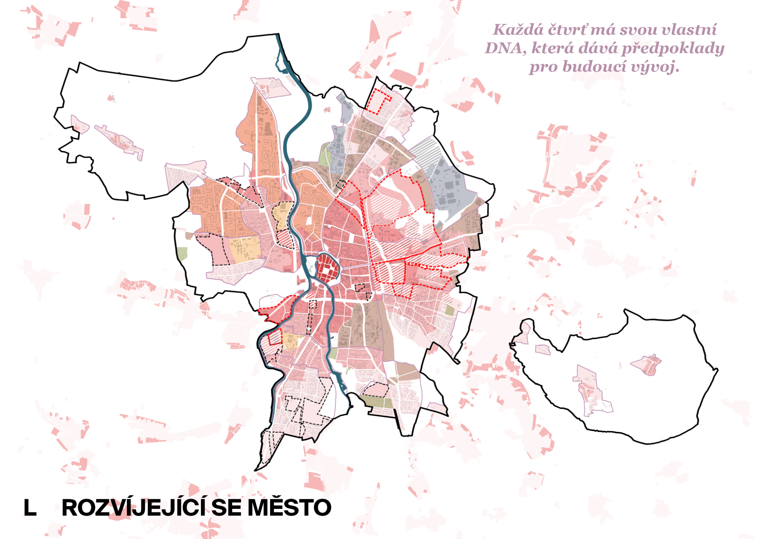
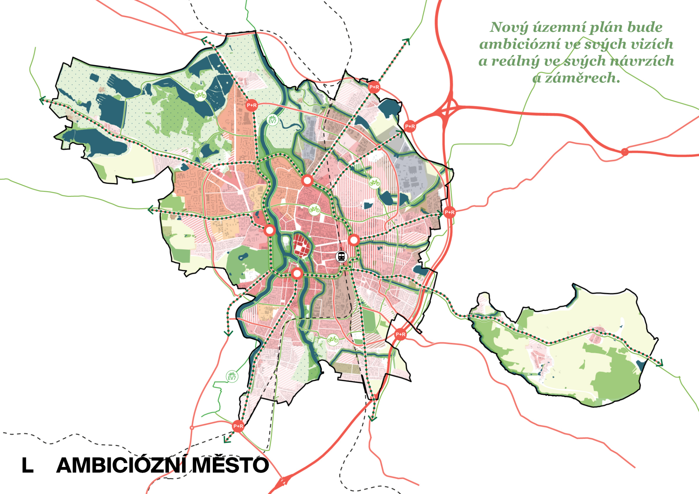
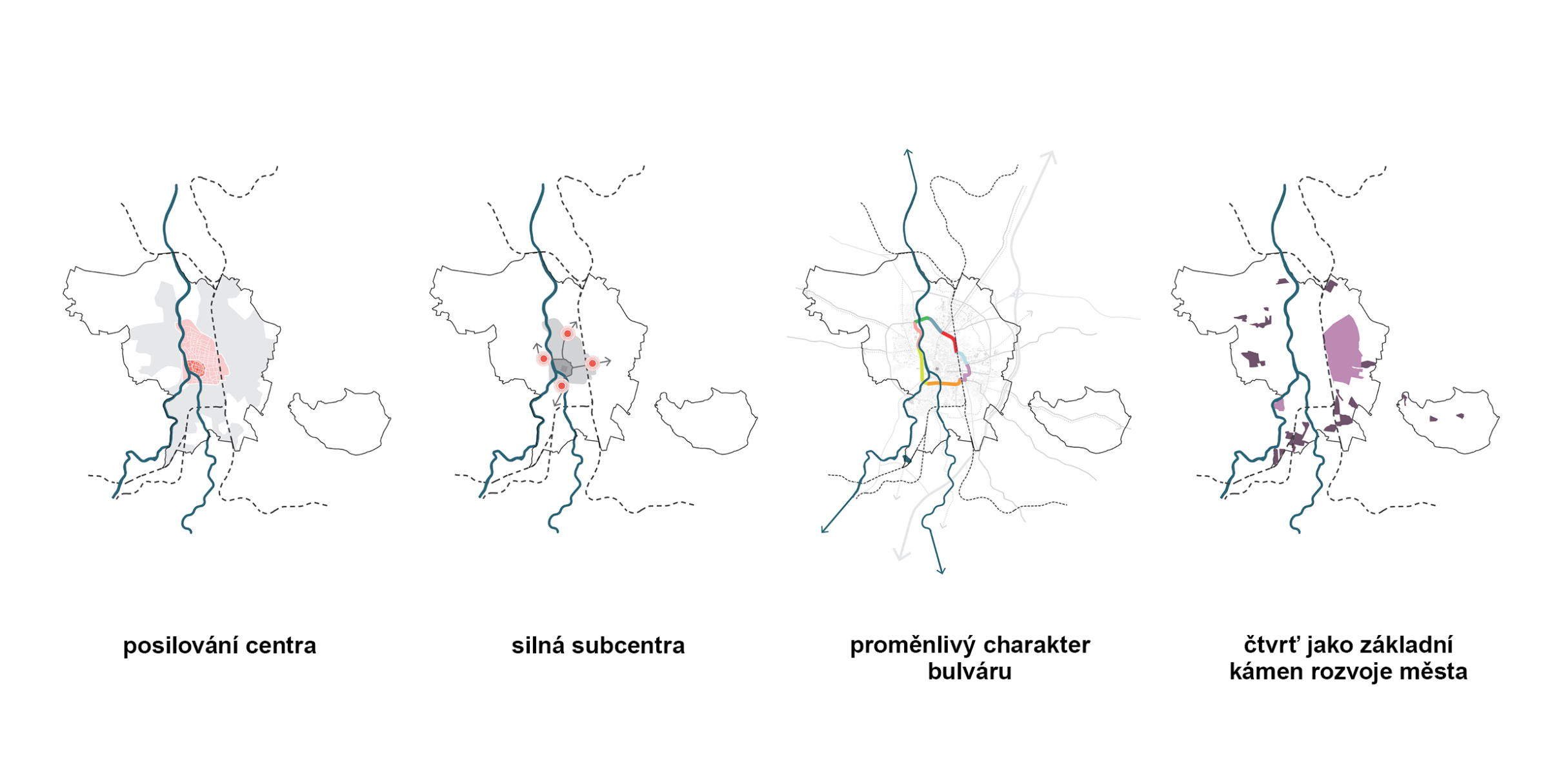
L City-wide level – main strategic concepts
At the second scale level (Large), we formulate basic concepts that impact the development of the entire city; these have city-wide significance and extend across multiple neighborhoods. For example, in the case of the transportation concept, this involves the design of roadways, pedestrian, and bicycle connections passing through multiple neighborhoods; in the case of the landscape concept, it involves the design of green “wedges” extending into multiple neighborhoods, the design of recreational use of riverbanks, the design of transformation areas, etc.
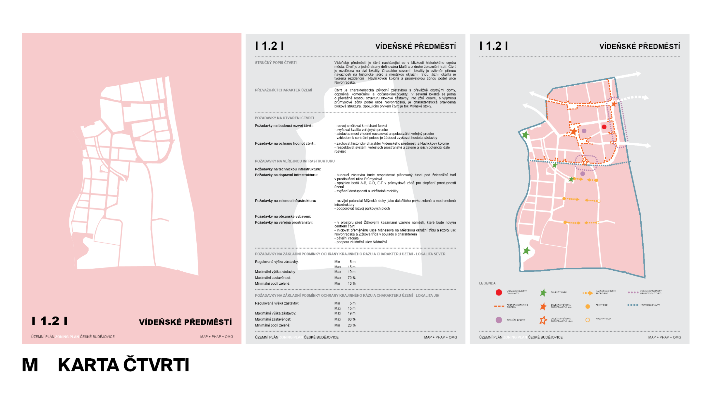
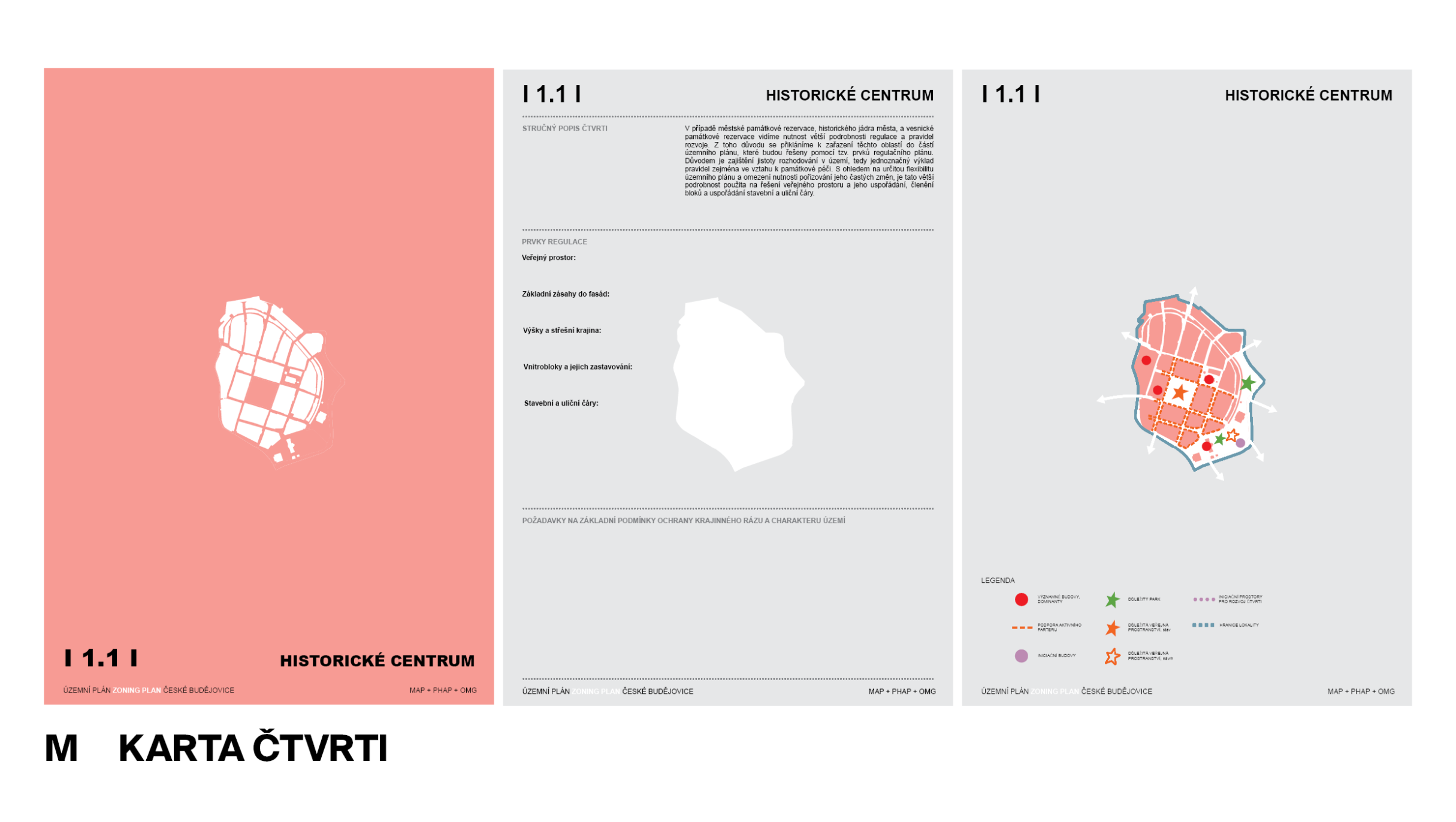
M Neighborhood Level – Visions for Individual Parts of the City
At the medium scale (Medium), we define individual neighborhoods by area, describing for each one its character, requirements for potential development, conditions for the spatial arrangement of buildings, etc. These neighborhoods take into account various characteristics that form the prerequisites for realizing the established ambitions.
S Detailed Level – Regulatory Measures and Land-Use Studies for Specific Locations
At the smallest scale (Small), we define specific neighborhoods or parts thereof, transformation areas, or developable areas where, due to the need for detailed planning or to achieve a set ambition, it is necessary to require the preparation of a land-use study or a regulatory plan.
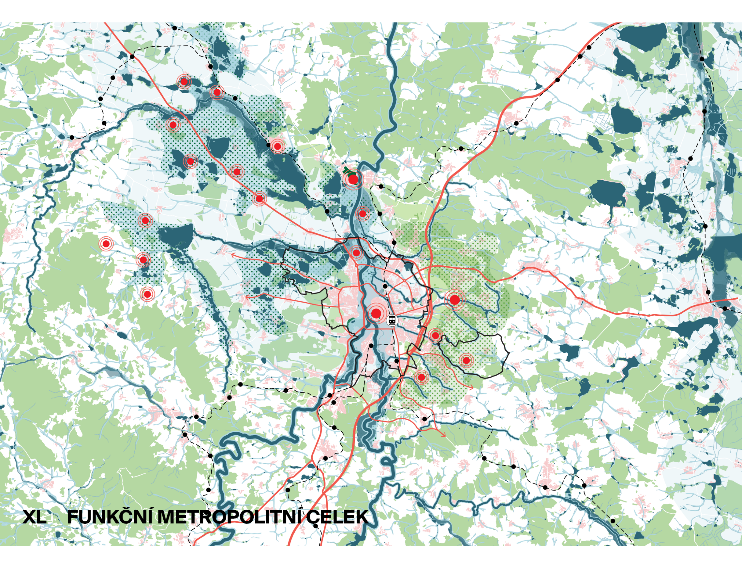
XL SCALE
České Budějovice, together with the surrounding municipalities, forms a functional metropolitan area. These municipalities utilize the city’s public amenities and employment opportunities, which leads to increased traffic congestion. The solution includes support for alternative modes of transportation (public transit, cycling, park-and-ride) and the coordination of land-use planning with suburban areas. A green space system is also essential; it will connect the city with the surrounding landscape and strengthen its ecological, recreational, and economic functions. This system should be incorporated into the land-use plan and supported by additional tools.
L SCALE
At the citywide scale, the focus will be on connecting individual neighborhoods—through vehicular traffic as well as pedestrian and bicycle accessibility. Emphasis will also be placed on their connections regarding the use of civic amenities and employment opportunities, as well as on addressing transformation areas that span multiple neighborhoods. It will be crucial to develop the potential of existing neighborhoods and establish development priorities in transformation areas. Given the planned population increase of one-third, it is necessary to assess the city’s capacity in terms of housing, employment opportunities, and public services. The concept therefore supports the development of employment areas, both through new zones and the transformation of existing industrial sites into mixed-use neighborhoods combining housing and economic activities.
M SCALE
A profile will be created for each neighborhood, outlining basic requirements regarding its current state and potential for improvement. The profile will also describe spatial regulations and requirements for new construction.
S SCALE
At Scale S, requirements for a zoning study or regulatory plan will be established for selected locations, transformation areas, and developable areas. If elements of a regulatory plan are utilized (e.g., for an urban historic preservation district or a village historic preservation zone), the proposal will include detailed requirements, particularly regarding the design of public spaces.